
 Italiano
 Français
The organization of the territory in the Roman era
The Romanisation of northern Italy implied a radical reorganisation of the territory. The new arrangement involved the creation of a wide network of roads, the rational division of cultivated lands (centuriatio), besides the foundation of new towns or the rearrangement of pre-existing settlements into an urban layout. The town was a sort of “Service Center” for a territory which had to be exploited in a rational way within an economy based on agriculture, sheep breeding and hunting.
The urban network of roads that intersected at right angles was the basic principle of Roman urban planning, derived from the Greek model. This system, however, was used in a non-rigid nor uniform way. There was a basic pattern, which was used in different ways, paying attention to the nature of the soil and the road network, according to economic, historical or other needs.
This arrangement was inspired to the model of the Capital, Rome.
Thus many colonies, with their regular, almost square or rectangular plan, were meant to be “small Romes”, an image of the original city, the “square Rome”, founded on the Palatine Hill by Romulus, who indeed traced a square foundation trench.
In those cases where this scheme was difficult to be applied – given the irregularity of the terrain, particular historical and economic conditions, the extent of the population or other factors – the “imitation” of Rome was achieved through the arrangement of the forum and its monumental buildings according to the model of the Urbs. Occasionally one or more buildings were directly inspired by models in Rome: a temple (Capitolium), a theatre or a basilica. In some cases it was enough to place a reproduction of a statue which was particularly meaningful for the history of the Capital. During the Empire, in every public space stood a statue of the emperor or a gallery of portraits of the imperial dynasty.
- The main public buildings, such as the theatre, the amphitheatre, the baths, and so on.
- The walls, a tangible sign of the ideology of the new urban civilization, even though sometimes not necessary from a strategic-military perspective (Libarna was without walls).
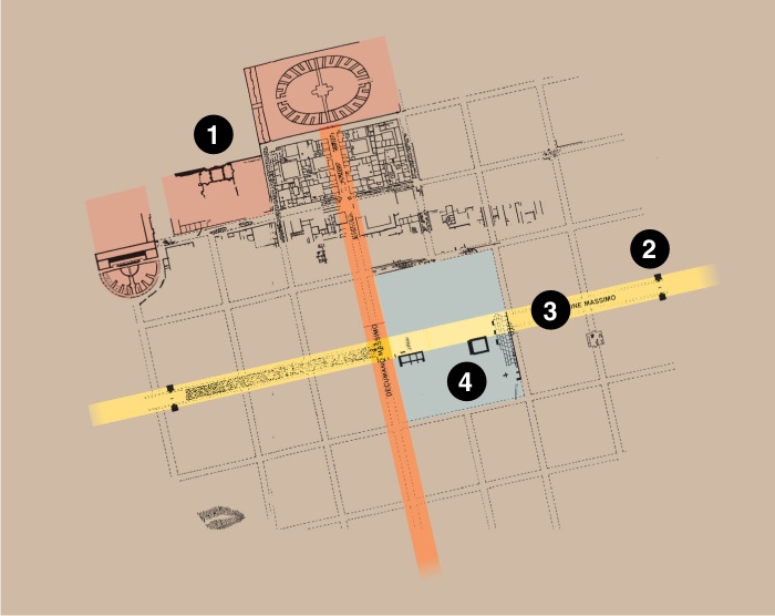
- The major cardo and decumanus, main roads of the town, which created the entire system by crossing each other.
- The forum or main square, where all the economic, political, administrative and religious activities of the city and related territory took place.